 Paikkatietohakemisto
Arctic SDI
Type of resources
Keywords
Contact for the resource
Provided by
Years
Service types
-
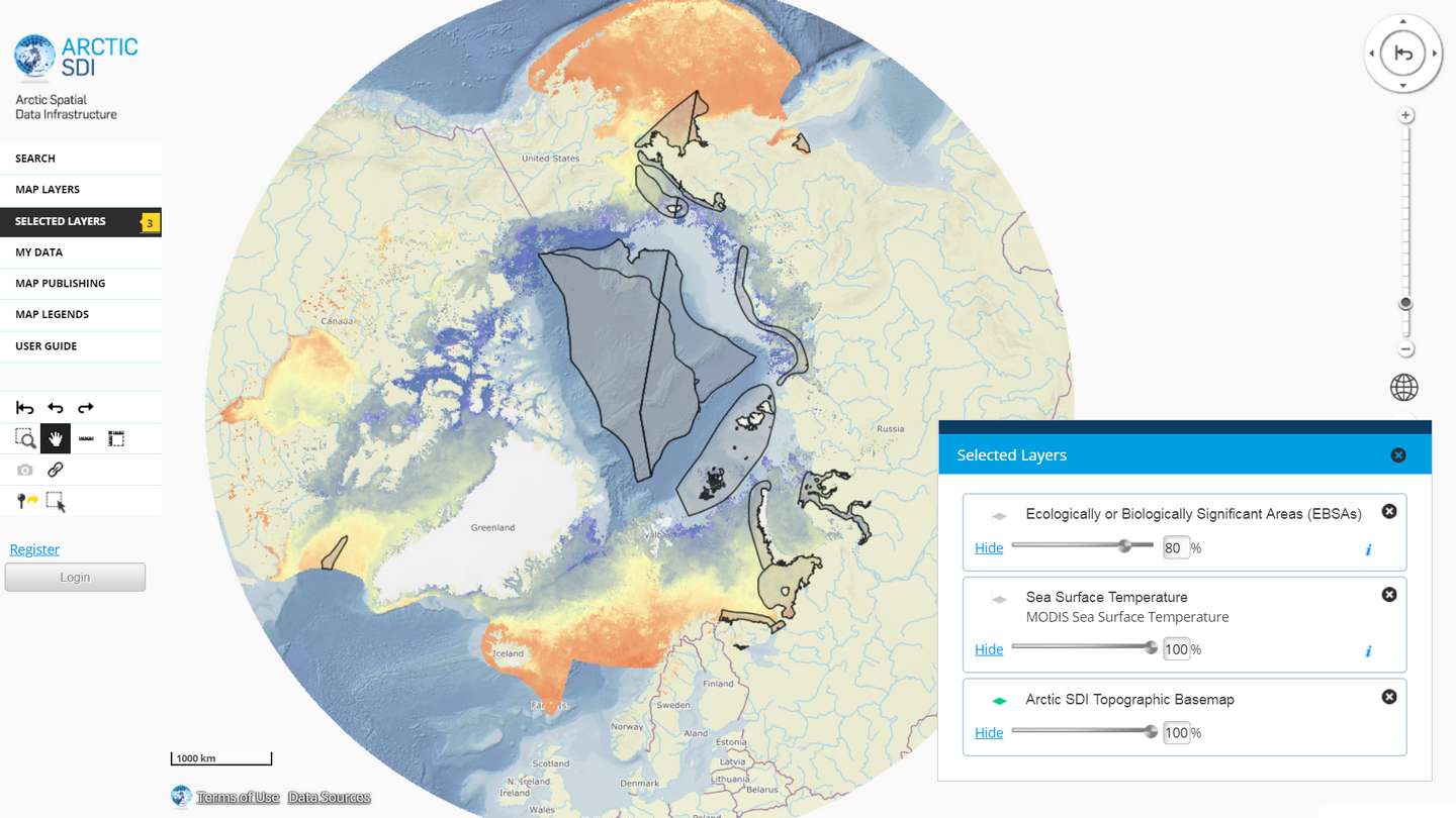
The Arctic SDI Geoportal provides access to geospatial data and services available via the Arctic SDI to support and facilitate monitoring, management and decision making, and support sustainable development in the Arctic. Specifically, the Arctic SDI Geoportal facilitates the discovery, visualization, evaluation, download and integration of geographic data from a variety of sources for the Arctic. The Arctic SDI Geoportal is the result of cooperative efforts between the National Mapping Agencies (NMAs) of the eight Arctic Council Member countries - Canada, Denmark, Finland, Iceland, Norway, Russia, Sweden and the United States. The Arctic SDI Geoportal includes reference data (such as the Arctic SDI topographic basemap or Pan-Arctic Digital Elevation Model) and thematic data from various sources. Thematic data section includes themes such as oceans, climatology and geoscientific information. Most of the data covers the Arctic or the involved Arctic countries, but new data sources with a smaller or larger geographical extent may be accepted. The Geoportal allows searching placenames via a circumpolar gazetteer, and embedding interactive maps to any website. Some of the features require registration.